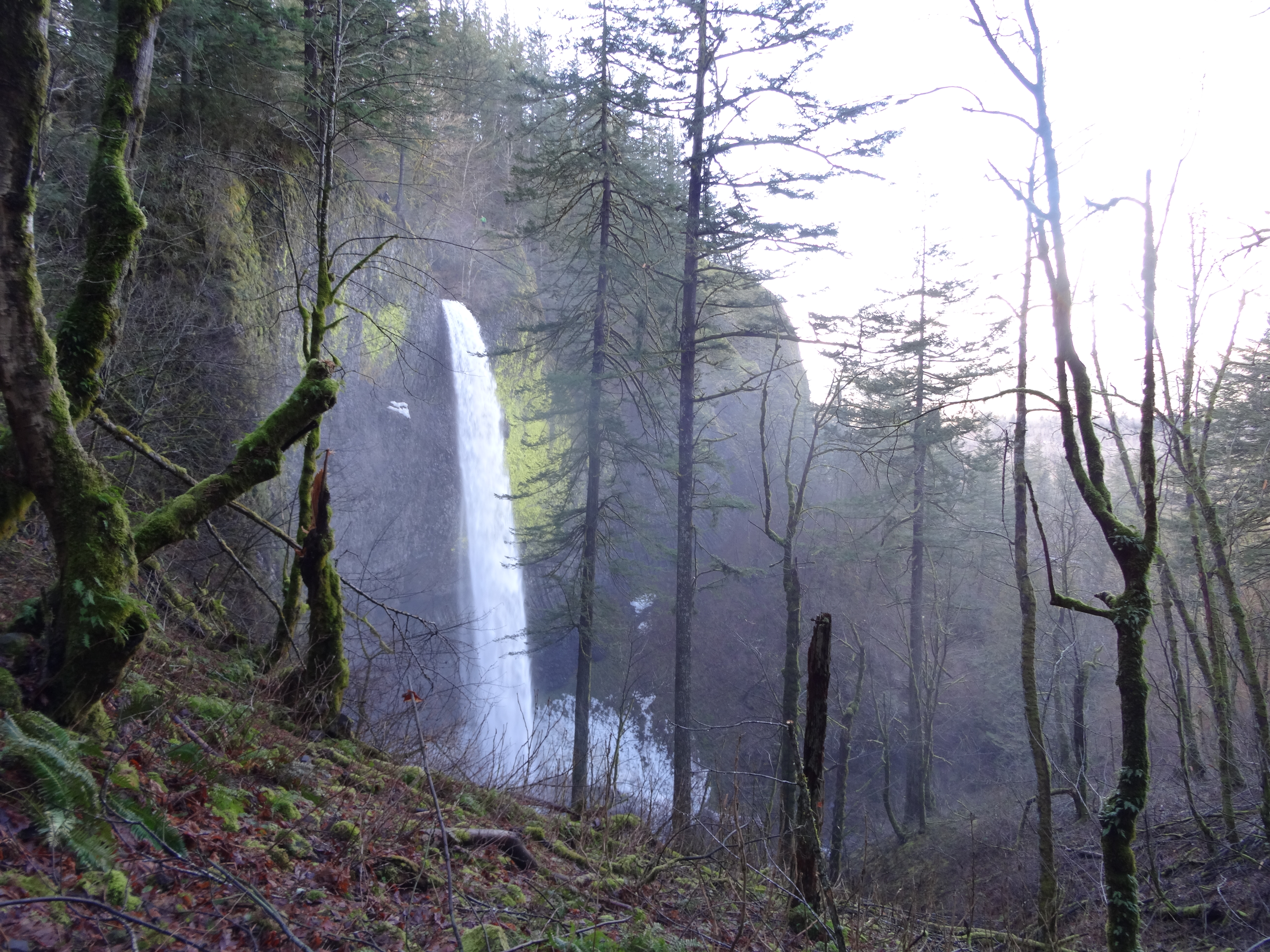
As the first major fall on the Historic Columbia River Highway, Latourell Falls provides a stunning welcome for first-time visitors. Here, Latourell Creek pours off a sky high slab of layered basalt in a towering and elegant plunge. The sheer size of the basalt cliff that surrounds the falls rises to cathedral-like proportions and embraces awestruck visitors. Colorful lichens adorn the surrounding cliffs, providing a textured backdrop to the white, icy plunge. If one can bear a good soaking, it is possible to climb behind the falls for an even more extreme view of the falling water and its overwhelming amphitheater.
All of this can be reached via a short and direct stroll from the parking area. Most visitors take this simple walk and hop back in their cars – off to the next fall! However, if one instead chooses to take the other path leading uphill from the parking lot, they can encounter mossy forest, a rushing creek, a 100+ foot upper falls, scenic gorge views and even… some solitude! All in a moderate 2.4 mile loop.
Upon heading uphill from the parking area, one is treated to unique views of the lower falls as the path makes its way up and around the massive cliff. Although the trail gains a lot of elevation, the climb isn’t too strenuous. Upon reaching the brink of the lower falls, the path meanders along cascading Latourell Creek for about a half mile until the upper falls comes into view. This fall is interesting as it starts as a wide, frothy cascade that funnels into a tight notch in the cliff. The stream flows out of this gap with considerable force, slamming into the pool below. A bridge spans the creek directly in front of this falls, providing scenic (yet wet) views. One can go behind this falls as well. The cave behind Upper Latourell Falls is an example of a paleosol, soil buried between stronger layers of volcanic deposits, that has been exposed by water erosion and has collapsed, allowing a cave to form.
From here, the trail continues along the opposite side of the creek to a lookout where one can gaze across the Columbia River. If it has rained enough recently, tall ephemeral waterfalls can be seen plunging into the river from cliffs on the Washington side. From here, the trail winds into the woods and descends back down to the road. Turn right here and walk back the parking area via a mossy bridge that spans Latourell Creek.
Driving directions: From I-5 N in Portland, merge onto I-84 E towards the Dalles. Continue for almost 30 miles to Exit 28 towards Bridal Veil. Exit here and shortly turn right on the Historic Columbia River Hwy. In roughly 2.8 miles, park at the trailhead.
Subscribe to the Mossy Log Newsletter
Stay up to date with the goings-on at Lewis & Clark! Get the top stories or your favorite section delivered to your inbox whenever we release a new issue.

Leave a Reply