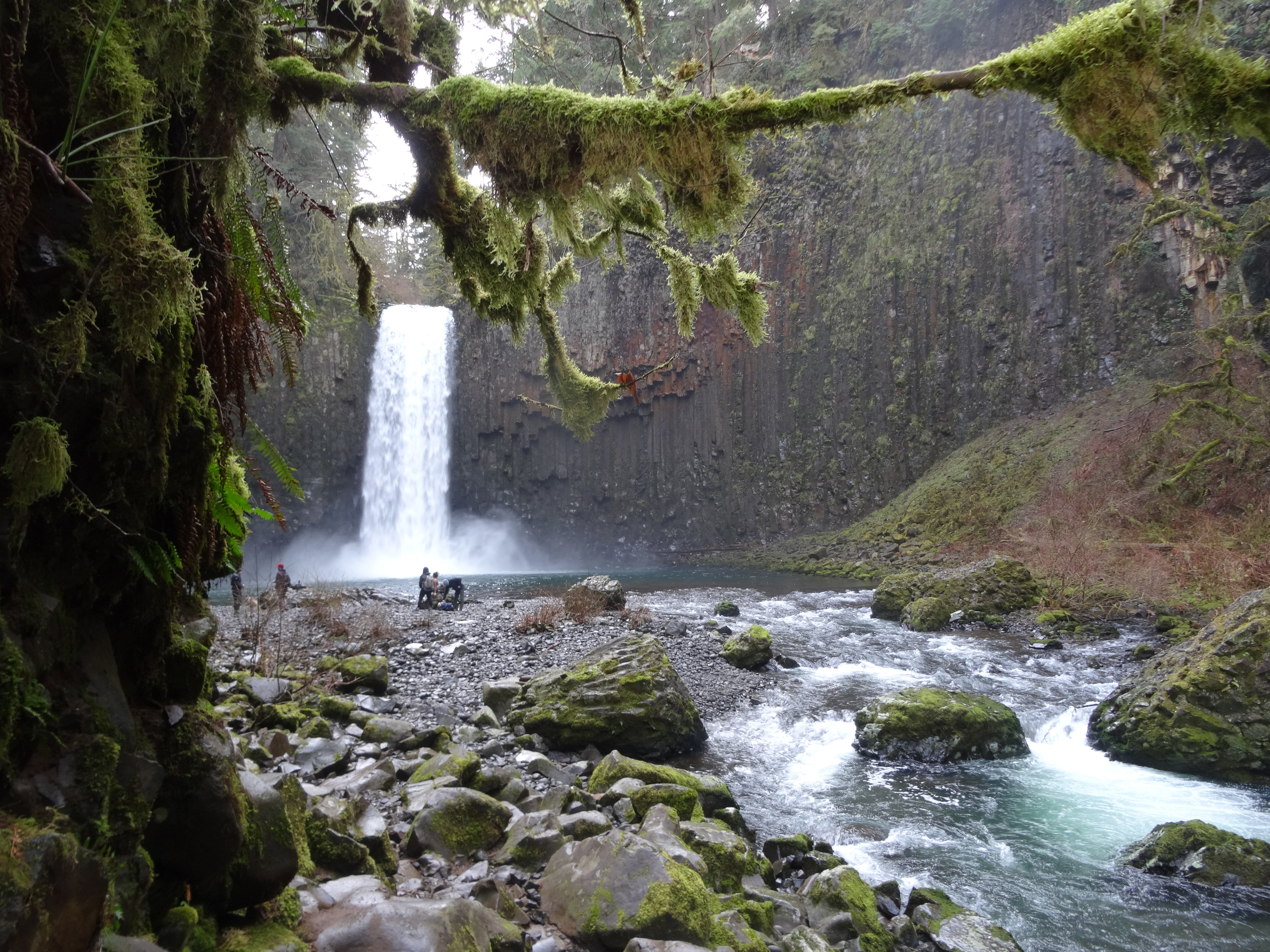
Beautiful at any flow — stunning in full throat, Abiqua Falls is a place of wonder. No words can describe the glorious scene that unfolds as one enters the falls’ majestic basalt amphitheater. Abiqua Creek pours in picture-perfect fashion, plunging nearly 100 feet into an expansive pool. Not only are the falls stunning – the surroundings are overwhelming. Abiqua Falls displays some of the most striking and unique columnar basalt formations in Oregon. Diverse species of lichen and mosses grow on these cliffs, adding colorful textures to the scene.
The long and possibly arduous journey to the falls makes the destination all the more satisfying. The Abiqua Falls Trailhead lies at the end of a long, rough and winding dirt road. Although the official trail to the falls is a mere quarter mile in length, most will have to hike at least a mile or two on the road because of rough, rutted road conditions. From Crooked Finger Road, follow road CF300 downhill for about a mile to a large parking area on the right. From here, it is about a mile and a half walk on the road to the official trailhead.
Avoid all spurs and keep heading down towards the creek. Ugly clearcuts mar the scenery above the creek. Logging aftermath is starkly evident here. Upon reaching the creek one will be able to slightly see the top of the falls. Do not take any spur trails here as they will lead to steep and treacherous drop offs. Instead, follow the road about a quarter mile further to a sign stating that the area is owned by Mount Angel Abbey, but public access is allowed. The Abbey is generous in opening this beautiful falls to the public, please be considerate.
The striking basalt formations seen along the creek and at the falls are all part of the Columbia River Basalt Group, a series of lava flows that erupted from fissures almost 17 million years ago. These lava flows comprise a large igneous province of basaltic rock that stretches throughout much of eastern Oregon, eastern Washington and western Idaho. A bulk of these flows spilled through the Columbia River Gorge, and scraped the northern end of the Willamette Valley — where Abiqua Falls is located. Abiqua Falls itself lies on the Scotts Mills Formation, a thick sequence of volcaniclastic sediments. The falls lies on the Abiqua Member — the middle layer of this formation. The basalt columns and joints around the falls formed when the rock contracted as it cooled. The fracture pattern that forms at the cooling surface tends to run down the lava as it cools, forming geometric columns.
The trail becomes steep during the final descent to the creek, ropes are in place for assistance. Upon reaching the stream, all evidence of clear cutting becomes a distant memory as tall evergreens and moss-draped deciduous trees dominate the scene along crystal blue Abiqua Creek. Follow the creek upstream for shortly to the falls. There is a large gravel beach here, perfect for relaxing on any day. Much time can be spent here exploring Abiqua Falls’ mighty basaltic bowl or just simply sitting and being mesmerized by its graceful plunge.
Subscribe to the Mossy Log Newsletter
Stay up to date with the goings-on at Lewis & Clark! Get the top stories or your favorite section delivered to your inbox whenever we release a new issue.

Leave a Reply