While the Lewis & Clark community rightfully celebrates the campus’ proximity to Tryon Creek State Natural Area, an equally gratifying outdoor setting sits just four miles north of Palatine Hill. Marquam Nature Park, Portland’s third-largest park, encompasses over 200 acres of undeveloped forest in the Tualatin Mountains. Seven miles of trails switchback 1,075 feet of elevation gain, climbing and descending two large ravines that cut through Marquam Hill.
The park’s origins began in 1968 when a small group of Marquam Hill residents successfully stopped the construction of a large apartment complex in Marquam Ravine. Over the next decade, the residents raised funds and collected small parcels of land to form what is now Marquam Nature Park. In 1989, Portland Parks & Recreation acquired the land and designated it for public use. Today, the Friends of Marquam Nature Park, a nonprofit volunteer organization, works with the City of Portland to preserve the park and educate the public on its culture and history.
Marquam Nature Park is accessible through numerous trailheads, most of which lie along Terwilliger Boulevard, Sam Jackson Park Road and residential streets atop Marquam Hill. From the Marquam Shelter and Mosaic trailhead on the north end of the park, hikers can easily connect to Sunnyside Trail, Shadyside Trail and Basalt Trail, which offer several miles of loops minutes from downtown Portland. To the south, beginning at the Marquam Trailhead on Terwilliger Boulevard, hikers merge onto Marquam Trail, the longest in the park, but quickly find junctions with Flicker Trail and Warbler Trail. If steep climbs and descents are a hiker’s desire, this southern portion of the park provides hilly terrain amid pristine Pacific Northwest flora. The heart of the park sits blocks away from the sprawling hospital complex upon Marquam Hill (colloquially known as Pill Hill), served by two trailheads that lead to several loops along deep ravines, trickling streams and lush fern forests.
If recreators desire a longer trek, Marquam Nature Park’s footpaths connect to a number of other trail systems in Northwest Portland. The most notable begins at Marquam Trailhead on Terwilliger Boulevard, where hikers can walk three miles on Marquam Trail until it reaches Council Crest, the highest peak in Portland. When skies are clear, Council Crest features stunning views of downtown Portland, Mount Hood to the east, Mount Jefferson to the south, and Washington’s Mount Saint Helens, Mount Adams and Mount Rainier to the north. Beyond Council Crest, hikers can continue north on Marquam Trail, cross Highway 26 via the Canyon Road overpass and connect with Wildwood Trail. At 31 miles in length, Wildwood Trail is the longest soft-surface hiking trail in the urban United States, crisscrossing Forest Park and the Tualatin Mountains.
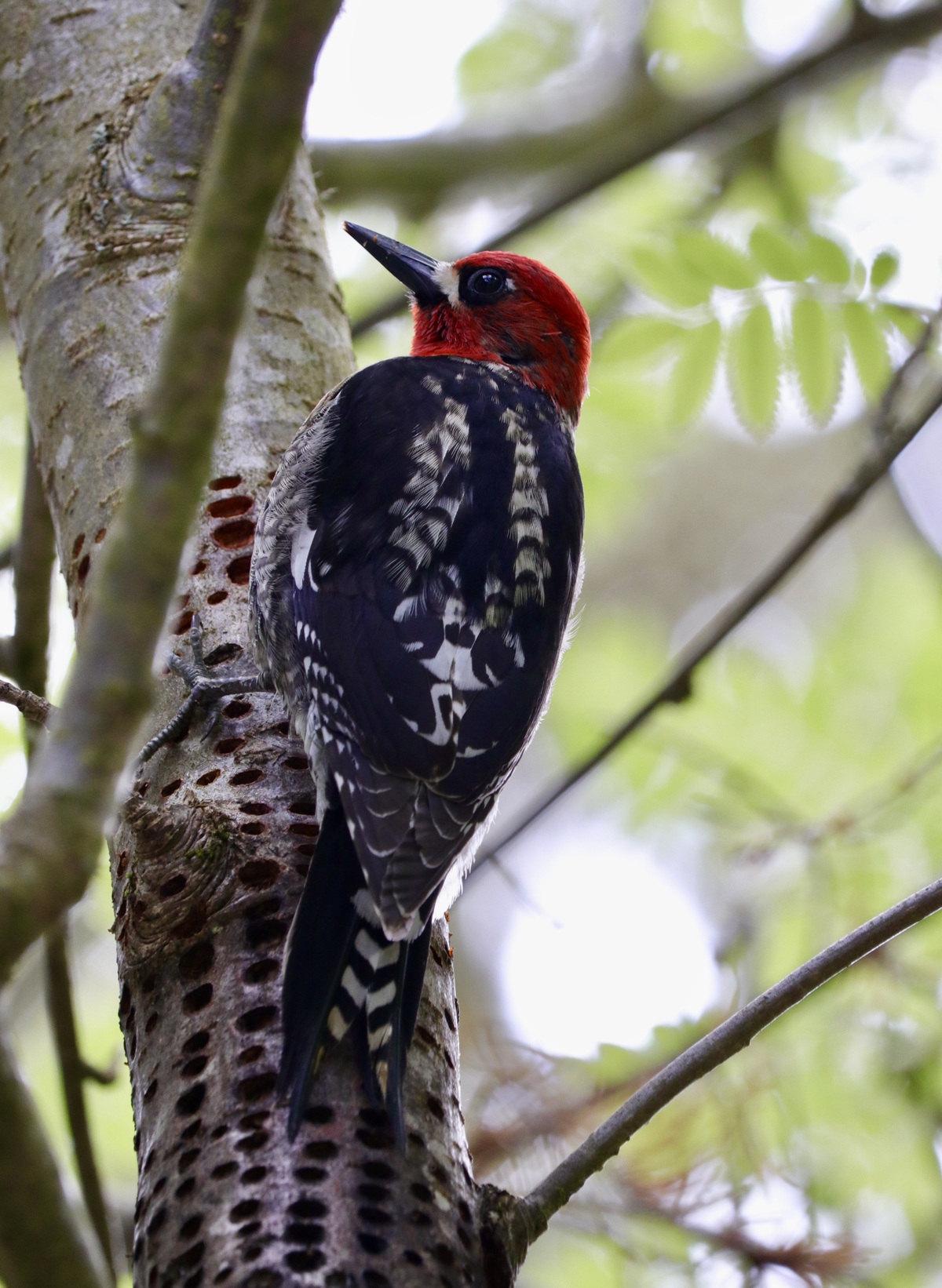
Those that wish to avoid strenuous activity will find tranquil opportunities within Marquam Nature Park. Fans of fauna will appreciate the park’s status as a bird watching and wildlife photography haven. In the northern end of the park, pileated woodpeckers and barred owls regularly catch the careful eye of passersby. Northern flickers, hairy woodpeckers, American goldfinches and numerous species of colorful finches and jays are common trail companions across the park. A healthy population of coyotes, whose howls are frequently heard at night, roam around Marquam Nature Park, as do Columbian black-tailed deer. Lucky recreators may catch a glimpse of Roosevelt elk, which rarely make their way to the park’s highest points, or the ever-elusive cougars and bobcats.
Cycling is not permitted in Marquam Nature Park, though hikers are welcome to bring their pets. From LC, community members can board TriMet Line 39 until it reaches the intersection of Terwilliger Boulevard and Capitol Highway. Here, board TriMet Line 65 and disembark at Bancroft Terrace; walk south a few hundred yards to find Marquam Trailhead. Alternatively, continue on TriMet Line 65 until it reaches Campus Drive and board TriMet Line 8 for a short ride to the 12th Avenue Trailhead or Marquam Shelter and Mosaic trailhead.
Subscribe to the Mossy Log Newsletter
Stay up to date with the goings-on at Lewis & Clark! Get the top stories or your favorite section delivered to your inbox whenever we release a new issue.

Great article! Thank you for informing the L&C community about this nearby natural treasure. Only one correction: the distance from the Terwilliger trailhead of the Marquam Trail to the top of Council Crest is only 3 miles, not 5.8.
Happy Trails! -Robin Jensen, Board Member, Friends of Marquam Nature Park